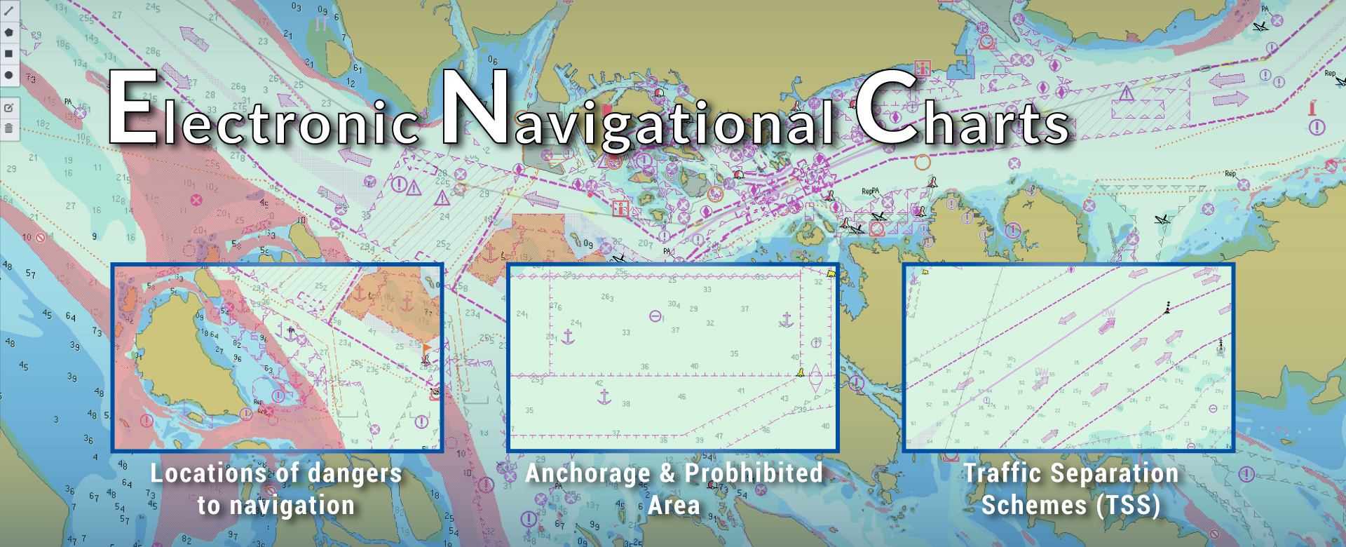
Electronic Navigational Charts
via Falcon Mega Track
Electronic Navigational Chart (ENC) requires no installation or download updates. Our service streamlines charts and automatically updates through web-based tracking platform,
Falcon Mega Track (FMT), leaving you free to focus on navigation with peace of mind.
Electronic Navigational Chart (ENC) includes a variety of features and information, such as coastlines, depth soundings, navigational hazards, traffic separation schemes, bathymetry, buoys, lights, submarine cables, wind parks, etc. This information helps mariners navigate safely on the water.
Key Features
Electronic Navigational Charts (ENCs) – Precision Navigation for Modern Maritime Operations
Navigate with confidence using our high-quality Electronic Navigational Charts (ENCs), designed to meet the needs of today’s maritime industry. ENCs are essential for safe and efficient navigation, providing accurate, up-to-date digital maps of waterways, ports, and coastal areas. Compatible with ECDIS (Electronic Chart Display and Information Systems), our ENCs ensure compliance with international maritime regulations while enhancing situational awareness for ship operators.
Why Choose Our Electronic Navigational Charts?
-
Accurate and Reliable: Our ENCs are sourced from trusted hydrographic offices and updated regularly to reflect the latest navigational data.
-
Global Coverage: Access detailed charts for major shipping routes, ports, and coastal regions worldwide.
-
Compliance with Regulations: Meet IMO (International Maritime Organization) and SOLAS (Safety of Life at Sea) requirements for ECDIS compliance.
-
User-Friendly: Easy to integrate with ECDIS systems, providing seamless navigation and real-time updates.
-
Enhanced Safety: Identify hazards, shallow waters, and restricted areas with precision, reducing the risk of accidents.
Applications
Our Electronic Navigational Charts are ideal for:
-
Commercial shipping and cargo vessels
-
Passenger ships and cruise liners
-
Fishing vessels and offshore operations
-
Naval and coast guard operations
Stay Ahead with the Latest Navigational Data
In the fast-paced world of maritime navigation, having access to accurate and up-to-date charts is critical. Our ENCs ensure that your crew has the information they need to make informed decisions and navigate safely.
Get Started Today
Explore our range of Electronic Navigational Charts and ensure your vessels are equipped with the best tools for safe and efficient navigation.
About Us
10+ Years Experience in Marine Electronics, and Authorized Service Providers of Major GMDSS Brands.
Quick Links
Products
Services
Accessories and Parts
Contact
Categories
AIS
SSAS
VDR / SVDR
Communication
Navigation
Products
VHF Base Radios
MF-HF Radios
Walkie Talkie Radios
GMDSS / SART / EPIRB
Satellite Communication
GPS / Plotters / ECDIS
Marine ARPA Radar

